
Walk a Henderson Street by Address
Begin with a complete postal address, but do not treat the postal form as the only form. Henderson maps split an address into number, number suffix, prefix direction, street name, type, suffix direction, and ZIP code. A unit matters. So does the date of the source. The aim is to move from a place to a parcel, from the parcel to an assessed owner, and from that owner to the recorded title trail.
- Normalize the address with the official USPS lookup. Keep the unit and direction, then test the same address in Henderson GIS.
- Click the mapped parcel and copy its PIDN, MAP_NO, subdivision, and lot. These keys are stronger than a street spelling alone.
- Carry the parcel or location to the Henderson County PVA and tax search. Keep the situs address apart from the owner's mailing address.
- Search the current owner as a grantee in the County Clerk deed index. Follow each prior grantor back by legal description, book, page, and date.
- Use voter records only through the lawful person-match route. For older occupants, ask the library for a reverse or criss-cross directory for the right year.
This street-by-street chain separates ownership, registration, and occupancy. No one source proves all three. When a result conflicts, compare the source dates and the exact lot or parcel before deciding two entries concern the same Henderson property.
Henderson Street Parcels Supply the Key
The Henderson public GIS viewer is the best visual starting point. Search an address, pan along the block, and click each parcel. The inspected public parcel layer did not contain an owner field. That omission is normal. GIS establishes geometry and identifiers, while the Property Valuation Administrator establishes the assessed owner.
| GIS field or tool | Use in a Henderson street directory search |
|---|---|
| ADDR_NUM, NAME, TYPE, ZIP_CODE | Build and check the mapped street address. |
| PIDN and MAP_NO | Join the map feature to parcel, assessment, and deed research. |
| SUBDIV, LOT, PLATTED_ACRES | Match subdivision plats and legal descriptions. |
| ZONE_, SFHA, TAX_DIST | Add zoning, flood, and district context, not proof of occupancy. |
| Measure, buffer, sketch | Define a block or segment; these tools do not export residents. |
The captured Henderson parcel layer schema shows the fields behind that join.
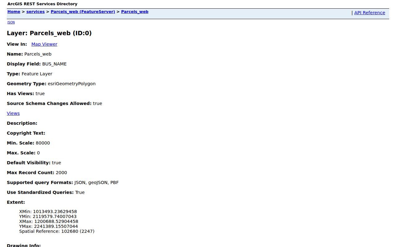
The schema makes the boundary clear: parcel identifiers and land facts appear here, but the current owner's name must come from the PVA record.
Note: A blank owner in the inspected GIS layer does not mean the Henderson parcel is vacant or unowned.
Henderson Street Directory Record Coverage
Several custodians keep address-keyed records. Each was created for a different job, so the meaning of a named person changes from row to row. The PVA office at 20 North Main Street, Suite 100 offers a basic property search and office help by phone at 270-827-6024. The County Clerk records deeds at Suite 206 and takes copy requests in person or by mail. City permit and code files add dated work and enforcement events.
| Henderson record | Address key | Person evidence | Access channel |
|---|---|---|---|
| PVA and tax roll | Situs, parcel, account | Assessed owner and mailing address | Online search, office, phone |
| GIS parcels | PIDN, MAP_NO, lot | No owner in inspected layer | Public map and FeatureServer |
| County deeds | Legal description, book/page | Grantor, grantee, return address | Online index, courthouse books, copies by request |
| Voter registration | Person and residence precinct | Matched registered voter, subject to protection | Individual lookup; formal voter-file process |
| Permit and code files | Address, PID, case | Applicant, owner, contractor when recorded | Monthly archives and custodian request |
| Old directories | Street number and name | Occupant or subscriber in some volumes | Library shelves, catalog, staff help |
The same street number can therefore name an owner in one record, an applicant in another, and a subscriber in a third. Preserve the label beside every name. That small habit prevents a Henderson street directory result from becoming a false statement about who lives there now.
Henderson Situs and Mailing Addresses
The Henderson property-tax search distinguishes an owner address from a property location. Property location is the situs, meaning the physical place being taxed. Owner address is where the bill or other mail goes. It might be a post-office box, an office, an entity address, or a home outside Henderson. Never merge those columns.
| Search mode | Account number, owner name, owner address, or property location |
|---|---|
| Account format | Use dashes when the record supplies them |
| Owner name | Try last name first and then an initial |
| Property location | Use number and street; the portal hint omits type and direction |
| Status controls | Include inactive accounts and choose paid, unpaid, or both |
Use the record date too. A tax account may lag a recent deed, and a deed mailing address can reflect where a buyer received documents on the day of transfer. This is a key myth to avoid: recorded ownership does not prove residence.
Browse Henderson Streets in GIS
Map browsing turns one address into a whole street segment. Search the first house, switch on Parcels and Addresses, then pan and click one lot at a time. Measure can mark the length of the segment. Buffer and sketch can hold a block in view. Zoning, flood, district, road, and utility layers add place context, but none is a household roster.
The Henderson GIS address service exposes the address fields used by the map.
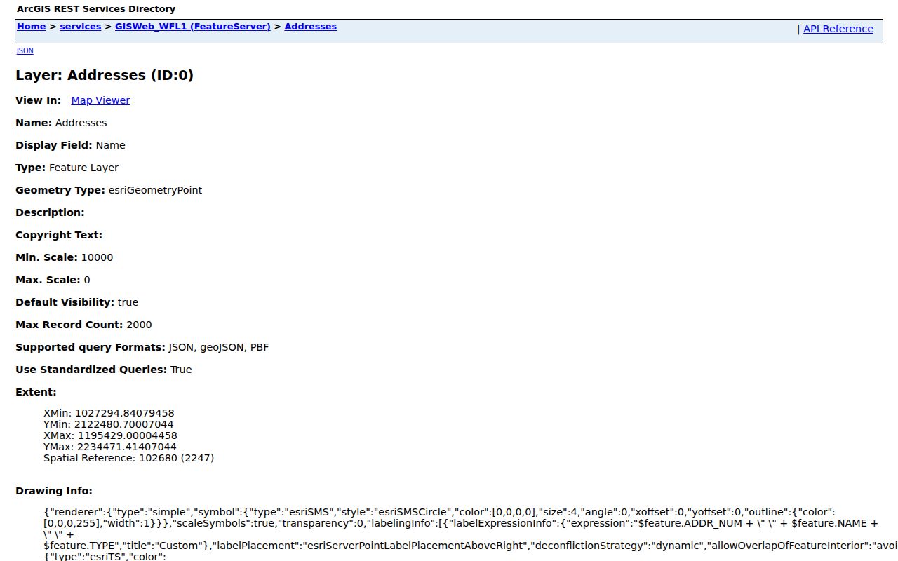
The field view helps explain why a failed search may need a different direction, suffix, or unit rather than a broader guess. For a whole-street project, keep a row for each PIDN and add owner evidence only after consulting the PVA.
The city also collects its public mapping links on the Henderson City Maps page.
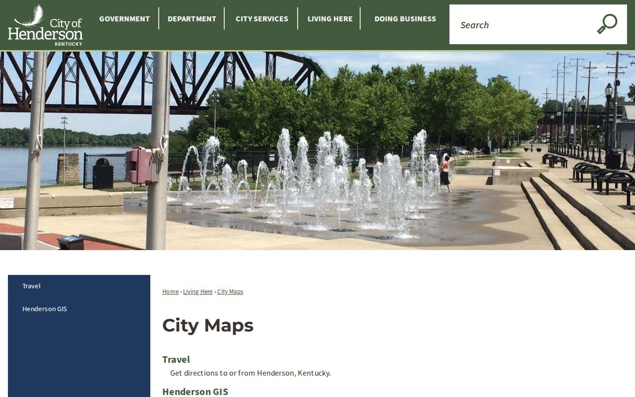
That city gateway is useful when an old bookmark fails, since it leads back to the maintained municipal map resources.
Henderson Deeds Extend the Street Directory
The Henderson County Clerk states that recorded documents reach back to 1786, while the online index begins October 4, 1960. Deed images begin June 5, 1973, and other indexed images begin June 8, 1973. That gap between the books and the web is crucial. A no-hit online search may still have a courthouse book, microfilm image, non-indexed document, or daily notebook entry.
Start with the current assessed owner as grantee, the recipient in a deed. Capture the prior grantor, who transferred the interest, along with legal description, instrument type, date, book, and page. Search backward. Add plats, easements, releases, mortgages, correction deeds, and lis pendens only when they clarify the same parcel. The County Clerk recording page lists the instruments and requirements; real-estate copies cost $0.50 per page plus the stated card convenience fee.
- Parcel
- A mapped and assessed unit of land identified by PIDN or map number.
- Situs address
- The physical location of the property, distinct from the owner's mailing address.
- Plat
- A recorded plan showing lots, blocks, roads, and easements in a subdivision.
- Criss-cross directory
- A directory arranged by street and house number rather than only by surname.
For material before the web coverage, call or visit the County Clerk, or send a focused copy request with the party, approximate year, instrument type, and book/page if known. The office, not the portal, is the final access route.
Renamed Henderson Streets Need Two Searches
Historic addresses can disappear under a new name. Henderson County's street-change records show First Street becoming First Avenue and Second Street becoming Second Avenue in 2001. Cemetery Road became Grandpa Jones Drive in 1996. Old Henderson-Corydon became Old Corydon in 1993. Records also preserve changes around Riverport and Industrial Park Drive, Eaton and Dana Drive, and Robards Alley and Railroad Street.
The official Henderson street-name change record gives the dated bridge between old and new forms.
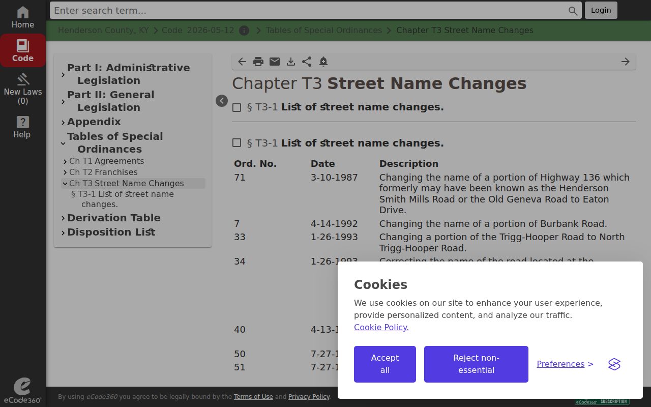
Search both names in deeds, directories, permits, newspapers, and GIS notes. Match the lot and legal description before assuming that a new suffix refers to the same parcel.
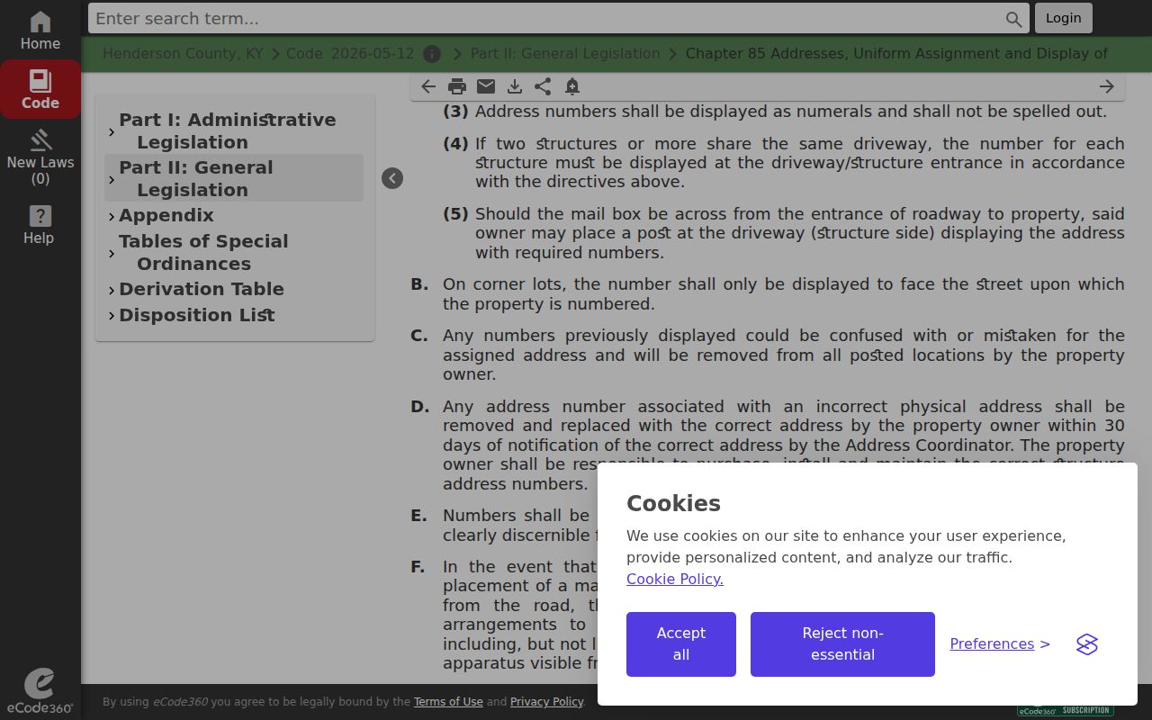
The city address ordinance can also renumber or rescind a nonconforming address and calls for notice to E-911, utilities, PVA, county agencies, USPS, and other services.
The Henderson addressing ordinance records that local process.
This official chain is more reliable than guessing that a missing old house number was a typo.
Henderson Address Files Date Buildings
Building permits and code cases help date work at a property. Henderson's monthly permit archive is visible for 2024 through 2026. Permits may cover new construction, demolition, remodeling, additions, accessory structures, and signs. The Building Codes and Permits office at 100 Fifth Street accepts in-person and phone questions at 270-831-1277, Monday through Friday, 8 a.m. to 5 p.m. Ask for older paper material by exact address and date range.
City final-order archives are visible from 2023. County code material can show CASE#, PID, property address, owner name, last-known address, status, and a download. Those labels must stay attached to their dates. An applicant may not be the owner, and a listed owner may since have transferred the parcel.
A focused records request should name the existing report, permit, case, or order. Kentucky open-records law does not require an office to create a new street-wide list. Note: Permit and enforcement files document an event at an address, not a complete Henderson household.
Older Henderson Residents by Street
The Henderson County Public Library reports city directories from 1876 to the present with gaps and telephone directories from 1925 to the present with gaps. Ask whether a selected year contains a reverse street section. If it does, compare the address entry with the alphabetical name entry and photograph the abbreviation key. A directory might identify an occupant, boarder, office, or telephone subscriber. It does not by itself establish title.
Library staff can help at 101 South Main Street or 270-826-3712. Hours are Monday through Thursday 9 a.m. to 8 p.m., Friday and Saturday 9 a.m. to 5 p.m., and Sunday 1:30 to 5 p.m. Give staff the year, both versions of a renamed street, and any house number. The fuller historical shelf belongs on the Henderson city directory collections page; the street task here is the address-to-name check.
Limits of a Henderson Street Directory
A public address search cannot reliably list renters, children, guests, or every household member. The individual voter lookup requires a person match, and a full street file is governed by KRS 116.095, 31 KAR 3:010, and the SBE-84 process. Protected voter addresses are withheld. Driver records are restricted by federal law, utility customer lists are not a public fallback, and USPS expressly says address normalization does not confirm a person or company at an address.
Source labels matter most when names appear. Assessed owner means the person or entity on the tax roll. Grantee means a party received a recorded interest. Applicant means someone applied for work. Subscriber means a directory or telephone listing was printed under that name. None automatically means current occupant.
Lawful use. Use Henderson address records only for lawful personal research. Never use a street directory to stalk, harass, intimidate, or harm anyone.
When safety is involved, respect Safe at Home and other protected-address programs. A missing address may be an intentional protection, an unlisted resident, a stale source, or a record outside the web index. It is not permission to seek a private substitute.