
Henderson ZIP Directory Coverage
Two Henderson codes appear often in city business, but they mean different things. The state ZIP reference identifies 42420 for Henderson, and USPS confirms it at the main street-delivery post office. Official offices often use 42419 with post-office boxes. Six other ZIP codes serve named communities in Henderson County outside the incorporated city. Keeping those county comparators separate prevents a rural address from being mislabeled as a city neighborhood.
| ZIP Code | Areas Covered | Post Office | Notes |
|---|---|---|---|
| 42420 | Henderson street delivery and city addresses | Henderson Post Office, 100 1st Street | Primary city ZIP; verify exact address at USPS |
| 42419 | Official Henderson PO Box and mailing use | Exact box-only designation not captured | Not evidence of a second physical neighborhood |
| 42402 | Baskett area, Henderson County | Rural county context | Outside the City of Henderson |
| 42406 | Corydon area, Henderson County | Corydon postal context | County comparator |
| 42451 | Reed area, Henderson County | Reed postal context | County comparator |
| 42452 | Robards area, Henderson County | Robards postal context | County comparator |
| 42457 | Smith Mills area, Henderson County | Smith Mills postal context | County comparator |
| 42458 | Spottsville area, Henderson County | Spottsville postal context | County comparator |
No unique single-institution ZIP for the city was found, and the inspected sources did not document a ZIP split or realignment year. That gap should remain explicit. A postal label can say Henderson because of mailing service while the parcel lies outside city limits. Conversely, a city office may receive mail at 42419 even though its physical counter is in 42420 street-delivery geography.
Henderson 42420 Street Delivery
Use 42420 as the main Henderson street-delivery starting point, then check the full address. USPS can normalize a street name, directional, suffix, and apartment or suite. If several matches appear, unit detail matters. The postal result verifies how mail should be addressed. USPS expressly warns that its result does not confirm that a person or company occupies the address.
View the Henderson Post Office service page for the local 42420 facility.
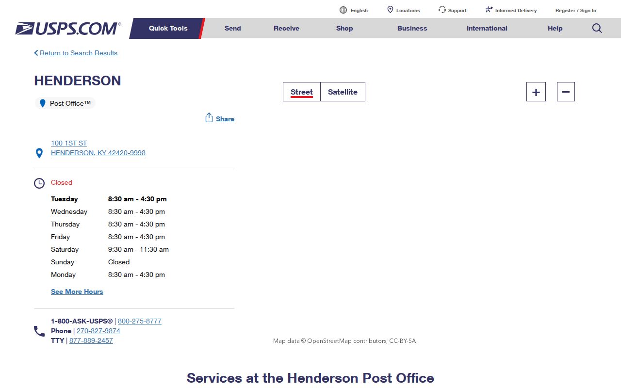
The listing identifies the Henderson Post Office at 100 1st Street, gives its phone as 270-827-9874, and shows that retail service hours vary by day.
Why Henderson Mail Uses 42419
The Henderson County Clerk uses PO Box 374 and the PVA uses PO Box 2003 with 42419 mailing addresses. That recurring official use is the strongest reason to keep 42419 in the ZIP code directory. Research did not independently capture a live USPS output that labels its exact station or box-only status, so it should not be described more narrowly than the sources allow.
A mailing ZIP is not a parcel location. Tax bills, deeds, and agency letters may go to a PO Box, an out-of-area owner, or another address selected for mail. When 42419 appears beside a person's name, treat it as a delivery lead. Use the property's situs address, which means its physical location, and the parcel key to establish where the land lies.
Postal quirk. Henderson offices use 42419 for mail while 42420 remains the primary verified city street-delivery ZIP.
Henderson County ZIP Comparisons
Baskett, Corydon, Reed, Robards, Smith Mills, and Spottsville belong in a county comparison, not a list of Henderson city neighborhoods. Their ZIPs help when a record says Henderson County but does not identify the incorporated city. Check the mailing city at USPS, then inspect the parcel geometry and city-limit layer before assigning municipal jurisdiction.
This difference is important for public records. City permits and code files follow city authority. County property, deed, election, and court records can cover parcels and people across Henderson County. A ZIP code directory can sort a broad result set, but the office that owns the record depends on jurisdiction rather than the mailing label alone.
| Address Key | What It Establishes |
|---|---|
| USPS ZIP | Current mail routing and standardized address |
| City-limit layer | Whether the location lies in incorporated Henderson |
| County | County clerk, court, PVA, and election jurisdiction |
| Parcel PIDN or MAP_NO | Land geometry and a stable join across local systems |
| Source date | When that version of the address or boundary was current |
Search Henderson Residents by ZIP
No verified public portal produces a complete list of Henderson residents from a ZIP alone. The GIS address layer carries a ZIP_CODE field and maps address points, but its parcel layer is not a resident roll. The tax site offers owner-address and property-location modes without a verified stand-alone ZIP field. The free voter match requires a known name and birth date, while broader voter data has a restricted request path.
- Verify the full delivery address with USPS, including an apartment or suite where known.
- Open Henderson City-County GIS and use the address point or parcel to test the location and city boundary.
- Carry PIDN or MAP_NO to the PVA, tax, or deed system to connect the place with an owner record.
- Use the free voter match only for a known individual. Qualified requests for broader voter data follow SBE-84 and Kentucky use limits.
- Save physical ZIP, mailing ZIP, city limit, county, parcel key, and source date as separate fields.
Once a ZIP narrows the area, use the Henderson street directory for the address-by-address record chain. That keeps a postal grouping from being mistaken for proof about a particular household.
Henderson ZIP Search Fields
Each official system treats ZIP data in a different way. USPS owns delivery normalization. Henderson GIS records ZIP_CODE on its address-point layer. Property systems divide the physical property location from the owner's mailing address. Kentucky voter records also distinguish residence and mailing ZIP fields, though public access depends on the route and requester.
| Official Source | ZIP-Related Input | What the Result Means |
|---|---|---|
| USPS By Address | Street required; unit optional; city, state and optional ZIP | Standard delivery address and ZIP+4 |
| USPS By City and State | City and state | Postal codes associated with that city label |
| USPS Cities by ZIP | ZIP | City names accepted for that postal code |
| Henderson GIS address layer | Address search; ZIP_CODE stored on address points | Mapped point and local geometry, not occupancy |
| Kentucky voter routes | No ZIP browse on free match; residence and mailing ZIP in full-file format | Personal match or controlled data request |
The PVA advanced search could not be verified because the live page was blocked during research. Its FAQ confirms basic ownership search and paid transfer or sales history, but not a ZIP filter. Do not promise a control that was not observed. Call or visit the PVA when the online form cannot answer the parcel question.
Henderson ZIP and Parcel Keys
Parcel identifiers solve many mailing mismatches. Henderson GIS publishes PIDN, MAP_NO, subdivision, section, lot, phase, unit, and block fields. The deed's legal description controls title, the PVA account concerns assessment, and USPS controls delivery. Those keys can describe the same place without using the same text.
Keep the physical ZIP apart from the owner's mailing ZIP. An owner may receive mail at 42419, another Kentucky code, or outside the county while the parcel remains in 42420. Renters and other occupants may never appear in the ownership record. For unresolved geometry, the Henderson City-County GIS viewer and Planning Commission address records are the fallback, followed by direct office help or a focused Kentucky Open Records Act request for an existing record.
Old Henderson Street Names
A correct present-day ZIP may still fail against an old record because the street name changed. Henderson's dated road table records examples such as First Street becoming First Avenue, Second Street becoming Second Avenue, Cemetery Road becoming Grandpa Jones Drive, and Old Henderson-Corydon becoming Old Corydon. Search both strings when comparing a city directory, deed, parcel, or postal result.
The city's addressing ordinance also explains how numbers are assigned, displayed, and shared with E-911 and other agencies. The 1797 town plan, broad downtown streets, and the Ohio River setting add local context for why postal, flood, grid, and parcel geographies can diverge. A ZIP code directory should preserve the old name beside the new one rather than treating a failed exact match as proof that the address never existed.
Henderson ZIP and City Limits
ZIP codes are mail routes, not municipal boundaries. Henderson County contains several rural postal areas outside the City of Henderson, and a Henderson mailing label alone cannot settle city authority. Compare the USPS result with the official city-limit or road map and the GIS parcel. Then select the city or county office that actually holds the permit, code, property, deed, election, or court record.
This limit also applies to population figures. The 2025 estimate for Henderson city is 27,822, while the county estimate is 44,255. That difference cannot be divided reliably by postal code using the sources captured for this project. No official ZIP population or ZIP-specific voter count was found. Keep city, county, and postal statistics labeled by their real geography.
- ZIP versus ZIP+4
- A five-digit delivery area versus the more precise four-digit add-on for a block, building, or delivery group.
- PO-box ZIP
- A code used for post-office box delivery rather than a street neighborhood.
- Unique ZIP
- A code assigned to one high-volume organization; none was located for Henderson.
- Carrier route
- A postal delivery path within a ZIP, not a city or neighborhood boundary.